Android Phones as Earthquake Early Warning Systems
Introduction: Smartphones as Seismic Sensors
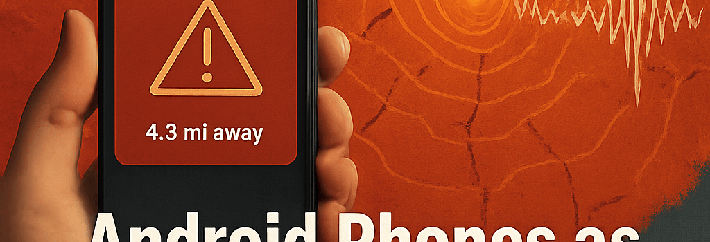
Since its US launch in 2020 and global rollout thereafter, Google’s Android Earthquake Alerts (AEA) has transformed millions of unassuming smartphones into nodes of a distributed seismic network. By leveraging built-in microelectromechanical systems (MEMS) accelerometers, AEA provides users in over 100 countries with seconds to minutes of actionable lead time before destructive seismic waves arrive. A new paper in Science (2025) and recent updates to the service shed light on the system’s technical underpinnings, performance improvements, and integration with public warning infrastructures.
Underlying Principle: Accelerometer-Based Detection
Modern Android devices ship with high-precision MEMS accelerometers, typically sampling at 200 Hz with a dynamic range of ±16 g and 15-bit resolution. When a phone is stationary, the local Earth motions remain the primary source of vibrations:
- P-waves (compressional, 5–7 km/s) are detected first.
- S-waves (shear, 3–4 km/s) follow, often causing more damaging ground motion.
Distinguishing earthquakes from routine disturbances—such as foot traffic, passing vehicles, or thunderstorms—relies on waveform analysis. AEA implements a multi-stage filter:
- Local RMS thresholding over a 1–2 second sliding window.
- Frequency filtering to isolate energy in the 0.5–5 Hz band typical of seismic events.
- Cross-correlation against synthetic templates derived from geological models (e.g., Stanford’s SeisShake).
Technical Architecture and Data Flow
AEA runs as part of the core Android system (typically in the “Earthquake” module of Play Services). When stationary for ≥30 minutes, the device’s Earthquake Detector service:
- Continuously buffers accelerometer data in device RAM.
- Invokes a low-latency signal processing pipeline via Android’s Sensor HAL.
- Upon local trigger, spools a single protobuf packet containing a short waveform snippet, timestamp, and quantized (3 km grid) location.
- Forwards the packet over TLS to Google’s cloud endpoint.
Cloud Infrastructure and Machine Learning Enhancements
On Google Cloud Platform, a fleet of auto-scaling microservices (containerized in Kubernetes clusters) processes up to 100,000 messages per second. In early 2025, Google introduced a TensorFlow-based neural network trained on 50+ years of USGS ShakeMap data. The model predicts:
- Earthquake magnitude (error <±0.2 Mw).
- Epicentral coordinates (median error ≈5 km).
- Likelihood of false positives (reduced to <0.2% overall).
These enhancements cut the false alarm rate by 80% compared to the 2022 baseline and improved magnitude estimation accuracy by 30%.
Integration with Public Alerting Systems
Beyond direct push notifications, AEA now integrates via the Common Alerting Protocol (CAP v1.2) with major government systems:
- USA: FEMA’s IPAWS (Integrated Public Alert and Warning System).
- Japan: J-ALERT network operated by the Fire and Disaster Management Agency.
- Mexico: CENAPRED’s national seismic alert system.
This federation allows alerts to propagate across radio, TV, and emergency sirens, achieving multi-modal dissemination within 5 s of cloud processing.
Case Studies and Performance Metrics
“On July 14, 2023, a Mw 6.6 offshore earthquake in the Philippines prompted AEA phones to detect P-waves in just 12 s, issue initial warnings 6 s later, and deliver up to 15 s of lead time before S-waves struck Manila.” — Dr. Maria Santos, Philippine Institute of Volcanology and Seismology
During the Mw 7.8 Mw 7.8 Türkiye earthquake of February 2025, AEA provided over 60 s of warning in cities like Adana and Gaziantep, thanks to high phone density and optimized wave-propagation modeling accounting for local sedimentary basins.
Privacy and Security Considerations
To protect user privacy and guard against abuse:
- Location data is coarse-grained to 3 km squares and never stored beyond 24 hours.
- Waveform snippets are encrypted end-to-end; no personally identifiable information is logged.
- Rate limits and anomaly detection shield the system from denial-of-service attacks.
Additional Analysis: Smartphone Sensor Variability
Not all accelerometers are equal. Google’s team profiled over 300 Android models, categorizing sensors by noise floor (20–50 µg/√Hz) and bandwidth. Dynamic calibration routines now adjust trigger thresholds per-device, reducing model bias across manufacturers.
Additional Analysis: Network Latency and Edge Computing
While most devices rely on centralized cloud processing, Google piloted an edge-compute architecture in California, colocating inference containers at the telecom provider’s edge. Early trials shaved off 2–3 s in end-to-end latency, increasing average lead time by 20%.
Future Directions and Challenges
Looking ahead, key focus areas include:
- Extending coverage to wearables and IoT devices with embedded IMUs.
- Developing generative AI models to simulate rare seismic scenarios for better training data.
- Addressing network blackouts post-quake via mesh networking and satellite uplinks.
Conclusion
From humble accelerometers to a global early warning network serving over 2.8 billion people, AEA exemplifies how consumer hardware, cloud computing, and AI can converge for public safety. As algorithms and infrastructure continue to evolve, the system promises even greater accuracy, lower latency, and wider integration—potentially saving countless lives in the years ahead.